📍 Navigate Covered Bridge Village – Maps & Location Insights
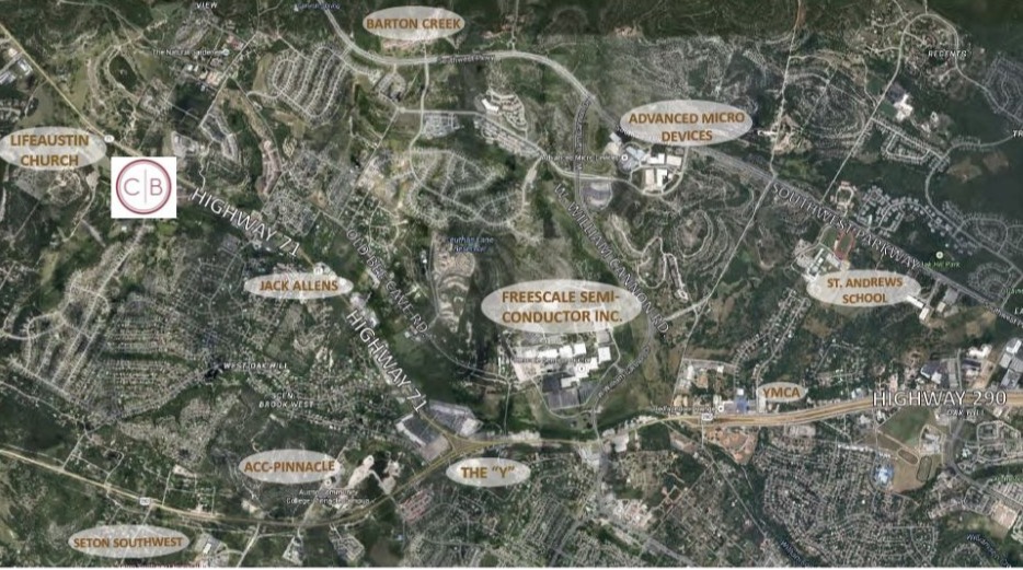
Planning your visit or considering Covered Bridge Village for your business? Our detailed maps provide everything you need, from zoning insights to parking availability and aerial perspectives showing key distances to surrounding areas.
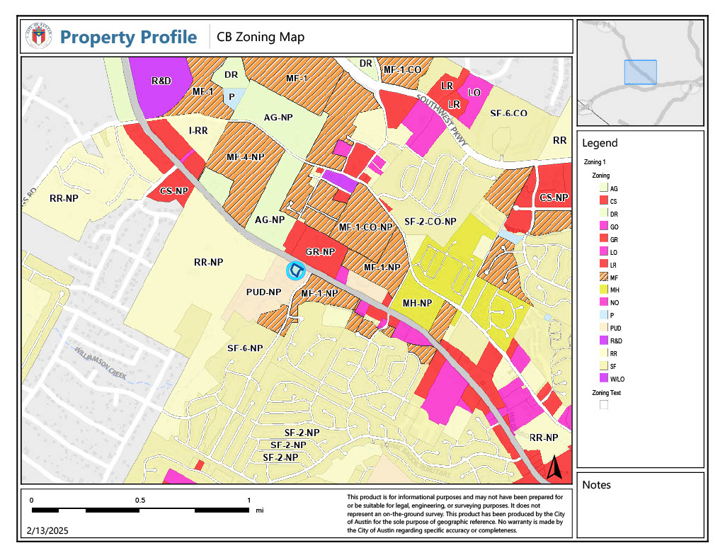
Zoning & Site Plan Map – See Your Business Fit
Understand the layout of Covered Bridge Village, including zoning designations, available spaces, and tenant placements.
🔹 Why It Matters: Whether you’re a retailer, office tenant, or future business partner, this map provides a clear look at where your business can thrive.
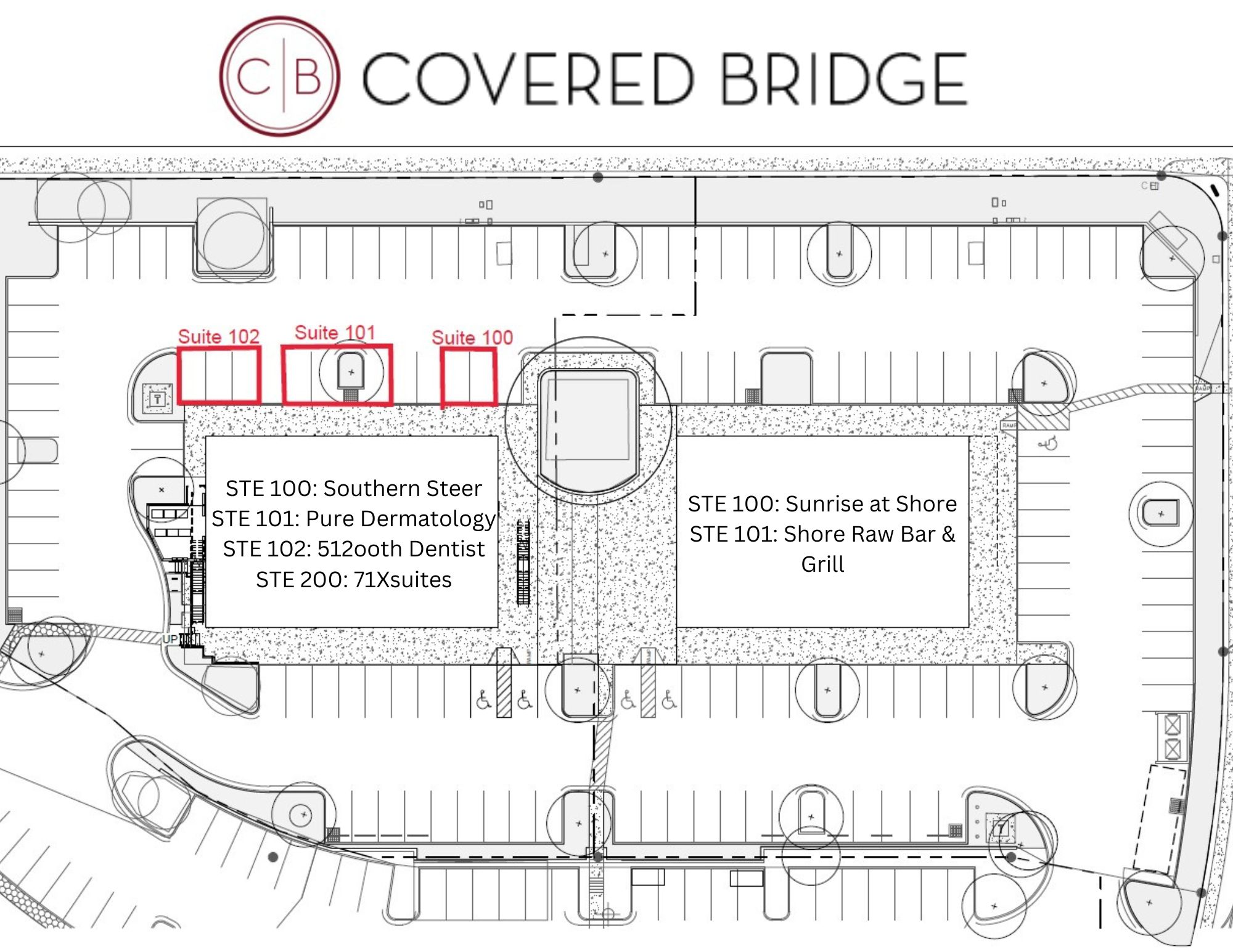
Convenient access and ample parking for customers, employees, and visitors.
Key Highlights: ✅ Strategically designed parking lots with easy access to all retail and office spaces. ✅ Future traffic light at Hwy 71 entrance for seamless ingress and egress. ✅ ADA-compliant parking and pathways for accessibility.